Seminars and courses
INAL SEMINAR: RESULTS PRESENTATION & DEVELOPED TOOLS WORKSHOP
VIELHA 17-18 MAY (Face-to-face and ONLINE)
SUBSCRIBE TO THIS LINK: https://forms.gle/8njR5ezVZ4KCwVLU8
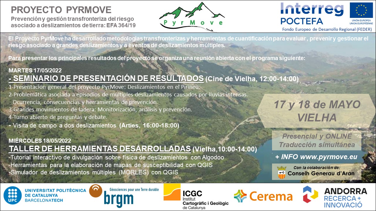
PROGRAM
Tuesday 17th May
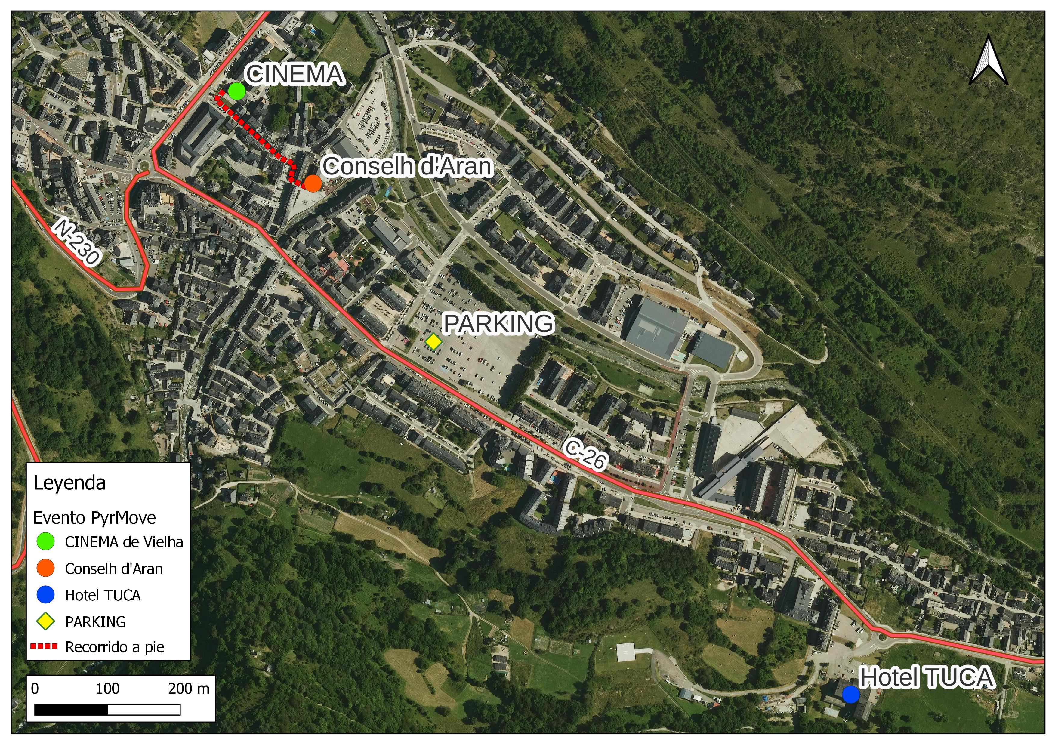
11:30 - 12: 00 Wellcome coffee break (Cinema de Vielha)
12:00 - 14:00 Results presentation seminar (Cinema de Vielha and online)
14:00 - 16:00 Lunch (restaurant to be defined)
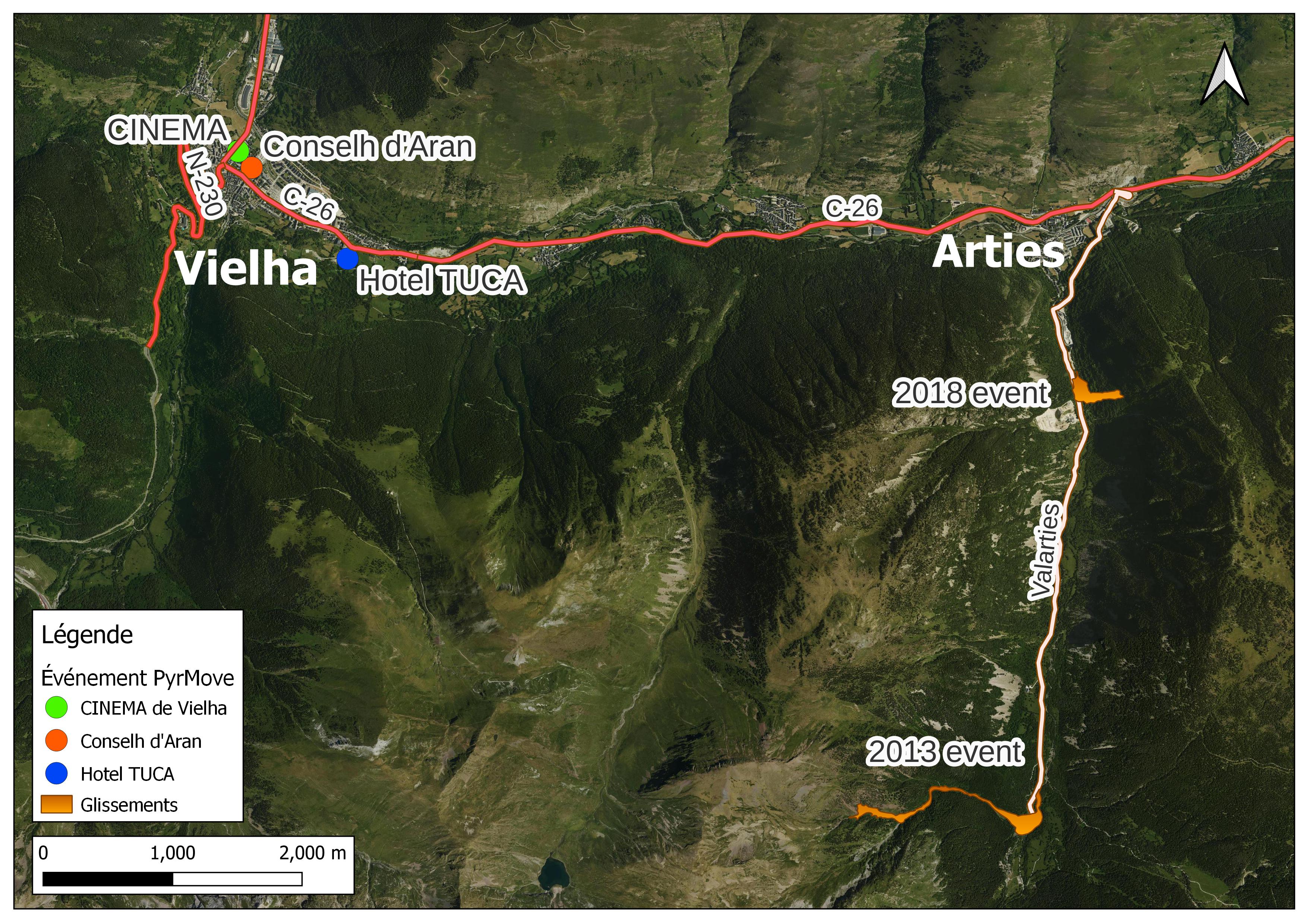
16:00 - 18:00 Arties landslides filedtrip
Wednesday18th may
10:00 - 14: 00 Developed tools workshop (Conselh d'Aran and online)
With a coffee break during the workshop.
14:00 - 16:00 Lunch (restaurant to be defined)
SUBSCRIBE TO THIS LINK: https://forms.gle/8njR5ezVZ4KCwVLU8
Landslide Monitoring for Early Warning Systems
(second edition, "April 2022")
April & May 2022, Wednesdays
Venue: online
This series of webinars is organized within the framework of ‘PyrMove’ and ‘GeoRisk’ projects as part of dissemination activities. The four one-hour webinars will present new techniques that might help in landslide monitoring and modelling. These new solutions may be the base of some Early Warning Systems for controlling and managing the risk, in order to reduce damage or losses. All the information to attend in the next link: https://drive.google.com/file/d/1NpJmexkzziY3Iy1ou2wom2ufzKc18NFU/view
Webinars agenda
Wednesday, 6th of April, 2022. 15h-16h (CEST)
Mixed Reality tools for visualization of complex spatial data in geomechanics. Joan Roca (BGC Engineering)
Wednesday, 20th of April, 2022. 14h-15h (CEST)
Distributed fiber optic sensing for geotechnical monitoring. Werner Lienhart (T.U. Graz)
Wednesday, 27th of April, 2022. 14h-15h (CEST)
Filling the gap between monitoring and modelling in geotechnical engineering. Cristian de Santos (SAALG Geomechanics)
Wednesday, 4th of May, 2022. 14h-15h (CEST)
Slope stability monitoring using Remote IoT Technology. Àngela Lluch & Victor Salines (WorldSensing)
Landslide Monitoring for Early Warning Systems
(Part 1, Remote sensing techniques)
April 2021, Wednesdays
Venue: online
This series of webinars is organized within the framework of ‘PyrMove’ and ‘GeoRisk’ projects as part of dissemination activities. The four one-hour webinars will present new techniques that might cover landslides with high continuity, and from the distance (Remote Sensing): Continuous Terrestrial Laser Scanning, Real-Time Radar monitoring, Ground-Based Synthetic Aperture Radar and Photomonitoring.
Webinars agenda
Wednesday, 7th of April, 2021. 14h-15h
Continuous Terrestrial Laser Scanning. Mark Williams (MAPTEK)
Wednesday, 14th of April, 2021. 15h-16h
Radar for critical monitoring. Martina Cheli (IDS)
Wednesday, 21st of April, 2021. 15h-16h
Ground-Based Synthetic Aperture Radar. Michele Crosetto (CTTC)
Wednesday, 28th of April, 2021. 14h-15h
Photomonitoring of landslides. Paolo Mazzanti (NHAZCA)
Practical directions to follow the webinars
The technical sessions will be held in English.
The attendance is free.
The webinars will be held online through a browser-based teleconference. To be invited to each session, a simple pre-webinar registration is required: you must send an email to EWS.webinars.April2021@gmail.com
indicating your intention to attend (specify which seminar (s)). You will receive the webinar link a couple of days before each session.
